Details
Views:
608
Tags
Data Info
Author
ASTOC , KEES CHRISTIAANSE
City
Hamburg
Country
Germany
Year
2000
Program
Mixed-Use District
Technical Info
Site area
1570000 sqm
Gfa
0
sqm
Density
3 far
Population density
16000
inh/ha
Home Units:
7500
Jobs
45000
Streetsroad:
0
%
Buildup:
1
%
NonBuild-up:
0 %
Residential
0 %
Business
0
%
Commercial
0
%
Civic
0
%
Description
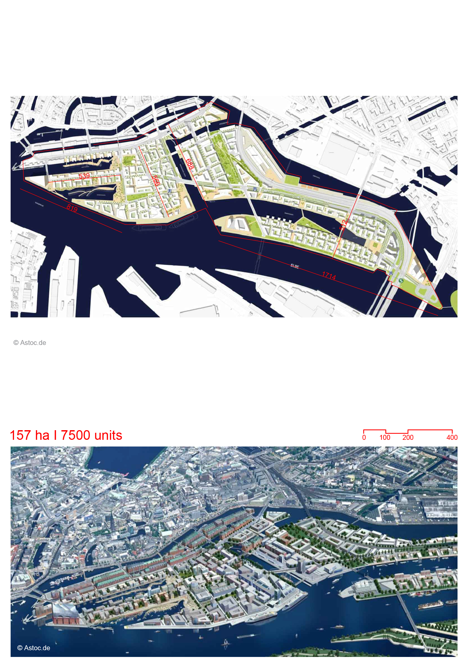
- The development is designed as a mixed-use urban quarter located on a former industrial site along the port.
- The masterplan incorporates mixed land uses to stimulate economic activity and create a city center character for the region.
- A variety of housing typologies will be developed near waterfronts and public green spaces, offering prime living locations.
- The area is divided into several self-sufficient quarters, each with a human scale and distinct identity created through water features and vegetation areas.
- Historic port structures will be preserved to maintain the site's industrial heritage.
- Waterfront connections are enhanced by orienting buildings to ensure water views even for buildings located in the "second row."
- Estuary habitats near the ports will be preserved, and environmentally compatible materials will be used in building construction.
- Noise pollution from the port will be mitigated with well-insulated windows, and floorplans will place private areas away from the port.
- The development will feature dense urban design with perimeter blocks and high-rise buildings, similar to those in European cities.
- The project has established its own Hafencity Eco Label to regulate the use of sustainable building materials like wood and wood-concrete composites.
- Smart mobility is a key focus, with a fine-grained network of urban spaces connected by robust pedestrian infrastructure to promote walkability.
- A new urban topography is introduced for flood protection, with buildings constructed on an artificial base known as the "Warft."
- Streets and sidewalks are elevated, and promenades are located at the existing port level, with airtight walls and flood gates ensuring the city's daily activities remain unaffected by rising water levels.
- The masterplan includes extensive urban nature, such as tree-lined avenues, fruit trees, and green fringes along promenades.
- A designated “enclosed wilderness” will be featured in Lohsepark, enhancing the ecological diversity within the urban fabric.
Mixed-Use Urban Quarter
Diverse Housing and Urban Design
Preservation and Connection to Water
Sustainability and Environmental Integration
Building Standards and Density
Smart Mobility and Pedestrian Infrastructure
Flood Protection and Topography
Urban Nature and Green Spaces
Location
Sources
Explore more Masterplans
|
